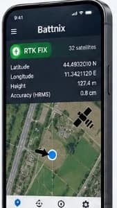
RTK and satellite status
See the current fix state and satellite count at a glance.

POSITIONING, MADE PRACTICAL
Your positioning workflow, right where the work happens.
OVERVIEW
A phone-first control surface brings receiver status and useful field tools together in one place.
See the current fix state and satellite count at a glance.
Review latitude, longitude, height and HRMS in one screen.
See your current position in relation to the surrounding area.
Keep map, record, status and settings tools close at hand.
A simple mobile workflow for pairing and checking connected hardware.
Keep field observations together for later use and sharing.